
If a picture says a thousand words, how many words does a 3D model say? Unmanned aerial vehicle (UAV) imagery and video has been a game changer in many fields, such as building inspections, construction progress monitoring, and surveying damage after disasters. Image and video capture is great, but it is only the beginning of a UAV’s full potential. Using sophisticated algorithms known as photogrammetry, it is possible to turn a series of simple images into a highly detailed and accurate 3D model of the natural and built environment.
In short, photogrammetry uses a series of overlapping images taken from different angles to compute the location of every pixel in each photo. Each image must be highly overlapped with neighboring images to capture the same features in multiple images for comparison purposes. Similar to solving an equation, the software uses the known values of picture capture location, picture capture angle, and the difference between common objects in each overlapping picture to determine the x, y, and z location of each pixel in each image. Each one of these pixels becomes a point in the 3D model.
Photogrammetry has been relegated to specialized scientific fields outside the public eye for most of its decades-long history. Recent years have seen a renaissance for this technology in self-driving vehicles and UAVs. Many production vehicles on the road today, such as those made by Tesla, use a series of cameras and photogrammetric technology as the basis for self-driving and obstacle avoidance technologies. The same technology is employed by UAV software platforms to turn simple 2D images into 3D models.
Uses
许多time-consuming tasks can be performed in a fraction of the time of traditional on-the-ground methods using a drone and 3D modeling. Here are a few examples:
- Terrain surveys.Documentation of surface elevation across a site. Useful for general site reconnaissance, cut/fill analysis, and generating elevation products, such as surface elevation contours or digital elevation models (DEMs).
- Volume calculations.Measuring the volume of material in stockpiles, or the volume of soil removed from an excavation. Faster and more cost effective than traditional methods involving truck-mounted LIDAR or physical measurement.
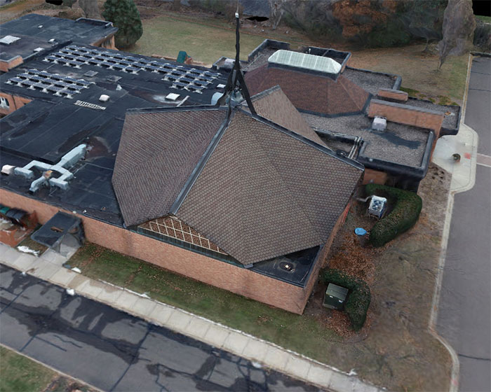
- Construction monitoring.Easily generate a detailed, photorealistic 3D model of construction progress that can be shared with stakeholders.


Accuracy
Is 3D modeling with a drone accurate enough to replace conventional, on the ground methods? The answer is yes in many cases, but there are caveats.
The final accuracy of a 3D model is correlated with the pixel density of the source images. The most common way to express pixel density is known as ground sample distance (GSD), which measures the amount of ground surface captured in each pixel. A ground sample distance of 1 inch/pixel means that each pixel in the image covers an area of one square inch. A low GSD equates to a high pixel density in the images, high density of points in the 3D model, and high accuracy in the 3D model.
Under ideal conditions, the final accuracy of a 3D model is approximately 1-2x GSD horizontally and 1-3x GSD vertically. This translates to an expected accuracy of 2-4 centimeters (0.75-1.5 inches) horizontally and 2-6 centimeters (0.75-3 inches) vertically. The best results will be obtained with a high-quality camera, relatively low flight altitude, highly accurate location measurements, optimal flight pattern, and an unobscured view of the surface to be measured.
If the following conditions apply to your project, it may not be a good candidate for photogrammetric modeling:
- Heavy vegetation on the site.The surface to be measured needs to be visible in the pictures. Heavy vegetation, trees, and other obstructions prevent accurate measurement of the underlying surfaces.
- Tall obstructions on the site.A drone operator must have freedom to choose the optimal flight altitude and pattern for best results. Tall equipment, power lines, towers or other obstructions may necessitate flying at a higher-than-optimal altitude or using a suboptimal flight pattern.
- True survey-grade accuracy needed.While 3D modeling is quite accurate when performed correctly, it is not a true survey. If you need a survey for legal purposes or need the highest possible accuracy, it is best to get a full, on-the-ground survey.
- FAA regulations.Some sites may be located in restricted flight zones due to proximity to airports and other sensitive areas. Also, flights over unsheltered personnel are prohibited by FAA regulations. A site that cannot be cleared of personnel or bystanders may not be a good choice.
Generating an accurate model of a site requires careful planning, specialized equipment, and a site with suitable conditions. An experienced drone operator will be able to assess the viability of a site by checking the airspace regulations, surface conditions, and asking the right questions. Braun Intertec has the equipment, experienced personnel, software, and knowledge to measure topography, calculate volume, generate detailed 3D building models, and many other efficiency-boosting uses. Contact our UAV team to explore the possibilities for your site.