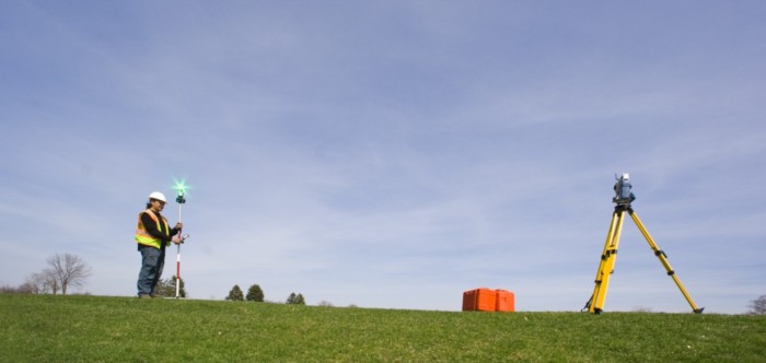

Braun Intertec utilizes its various GPS technologies for locating and acquiring coordinates including soil borings, sample locations, excavation bottoms and compaction tests. By incorporating Virtual Reference Station (VRS) and Real Time Kinematic (RTK) technology with our Rovers, we can also deliver survey grade elevations when needed. The Braun Intertec fleet of GPS equipment and our extensive device/data management experience provides clients with highly accurate collections of data and near real-time integration of results into supporting mapping products.
Our GPS Equipment Includes:
• Trimble R10/R8 GNSS RTK Rover with controller (survey grade)
• Trimble R10 GNSS RTK Rover with Win 7 tablet (survey grade)
• Trimble GeoXR Network Rover (survey grade)
• Trimble GeoXH (rated sub-foot accuracy)
• Trimble R1 GNSS Receiver (rated sub-meter accuracy)