Geospatial Operations
Capture. Integrate. Deliver.
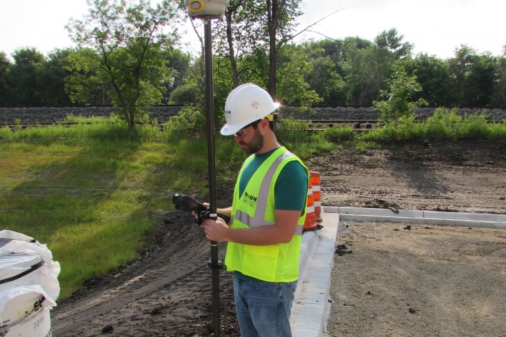
Geospatial Operations is the delivery engine for all geospatial services and technologies at Braun Intertec. We focus on providing our clients Computer Aided Drafting (CAD), Geographic Information Systems (GIS) and Global Positioning Systems (GPS) services utilizing specialized software, hardware, and trained specialists. Our Geospatial Operations specialists deliver creative and dynamic geospatial solutions, leveraging our vast array of data resources (both spatial and non-spatial) into intelligent, searchable, centralized, and distributable applications for our clients. Depending on your project needs, Braun Intertec selects the geospatial technologies that best capture, integrate and deliver accurate and near real-time geospatial data.
Featured Projects
-

Hastings Bridge Design-Build
The existing Highway 61 Bridge in Hastings spanning the Mississippi River is a two-lane bridge averaging 30,000 vehicles daily. Built in 1950, the bridge had ...
-
CapX2020
CapX2020 is a leading expansion of Minnesota’s electric transmission grid to meet the increased energy needs in portions of North Dakota, South Dakota, ...
